
The highest paved road in North America brings you up to the summit of Mount Evans at 14,130 feet above sea-level. As you can imagine the drive is gorgeous and breathtaking.
Before you go prepare yourself. Weather can change rapidly at the summit within minutes. Winter-like conditions can even arise during the summer and there are usually high winds up there. Bring sunscreen and dress in layers. Lightning strikes are also frequent. Seek shelter immediately, preferably in your car otherwise make yourself as small as possible. Stay away from cliffs and edges as wind gusts can push you over.
The only weather condition I experienced during my visit were high winds and a beautiful sunny day.
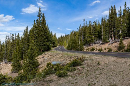
Start your trip in the historic mining town of Idaho Springs along I-70. Exit 240 will put you on CO Highway 103 which you will follow south up to Echo Lake.
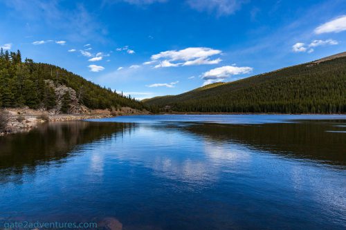
Echo Lake is a beautiful mountain lake that sits in a spruce forest at 10,600 feet above sea-level. Recreation activities at echo lake include camping, picnic, hiking, fishing, and wildlife viewing.

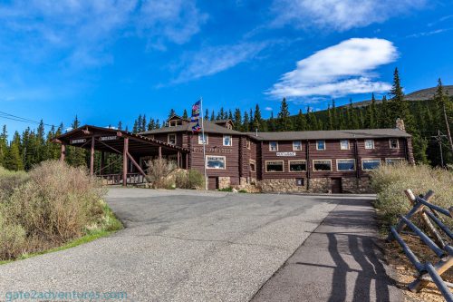
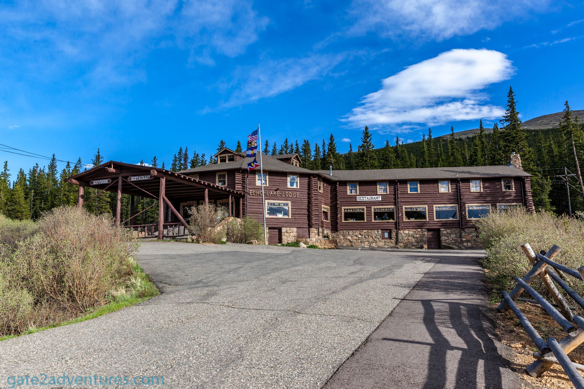
Stop at the historic Echo Lake Lodge visit the gift shop and take a meal before or after the visit to Mount Evan summit. It is the last restaurant and store before you will continue on Mount Evans Road which is also known as CO Highway 5.
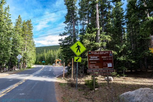
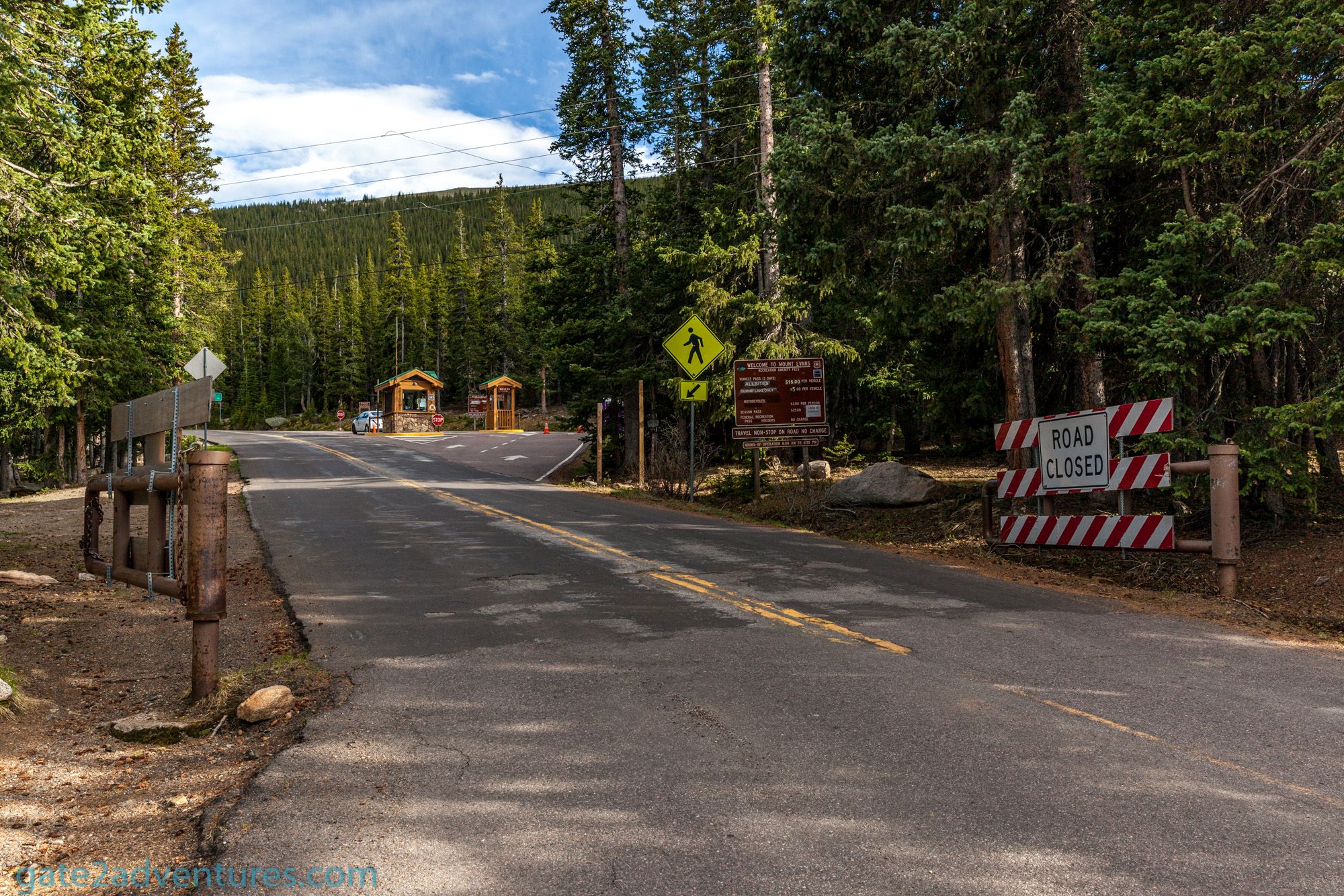
The turn-off to Mount Evans Road is right after Echo Lake Lodge. The road is usually kept open from Memorial Day through Labor Day but can be closed without notice in case of severe weather conditions.
Shortly after the turn, you will have to pay a small fee to enjoy the beautiful and scenic areas along the way to the summit and the summit itself. The fee is currently $15 ($10 for Fores Service Sites: Mount Goliath Natural Area and Mount Evans Summit + $5 for Summit Lake Park). If you do not plan to stop at Summit Lake Park you can save the $5. However, I would highly recommend you to stop there and take a short stroll along the trail.
Holders of a National Park Annual Pass are exempt from this fee and only have to show their pass while the welcome station is manned. If you are short on time, which I doubt you are if you are driving that much of course, you can use the “drive-through” option to not pay the fee. This allows you to drive up to the summit and turn back around without stopping along the way at any of the scenic areas and highlights along the route. Please don’t use this as an option to sneak in for free as the fees are used for the maintenance of the services provided. The fee structure is pretty complex and I had to figure them out as well. The easiest way is to buy the annual National Park Pass, which will give you also access to the Rocky Mountain National Park not too far from here. Passes are sold at the welcome center at the beginning of Mount Evans Road. The road is open 24 hours a day and will only be closed for severe weather conditions. The fees are only required during the official operation hours from 8 a.m. to 6:30 p.m.


Check the official website for updated information about prices and road closures. You will find the most up to date information there with closures for additional events throughout the season. Alternatively, you can check the Colorado Department of Transportation interactive map about road closures on CO-5.
During your 15-mile journey up to the summit, keep your eyes open for Rocky Mountain bighorn sheep, mountain goats, marmots, birds and alpine wildflowers!
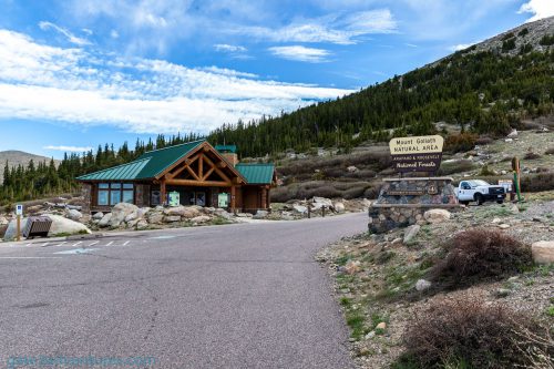
Mount Goliath Natural Area and Dos Chappell Nature Center
This is your first stop about 3 miles up the road from the welcome center. The nature center explains how plants and animals live in sub-alpine and alpine environments. 900 to 2,000-year-old Bristlecone Pine trees and an alpine garden can be found outside the nature center. The garden is accessible also outside the operating hours of the nature center.


Summit Lake Park
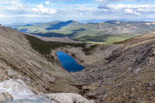
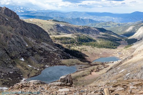
This is the next major point of interest along your way up to the summit. Summit Lake is located about 10 miles up and you can’t miss it. You will see the lake to your right just before you start the final ascent to the summit. Take a stroll along the trail and learn more about the area. This landscape was carved out by ancient glaciers over thousands of years. Keep your eyes open for wildlife and stay on the trails. Be careful if there is still snow around as it adds a trip and slip hazard on your hike. The lake was still frozen over when I visited end of May 2018.

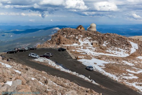
Summit of Mount Evans and Interpretive Site
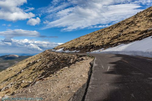
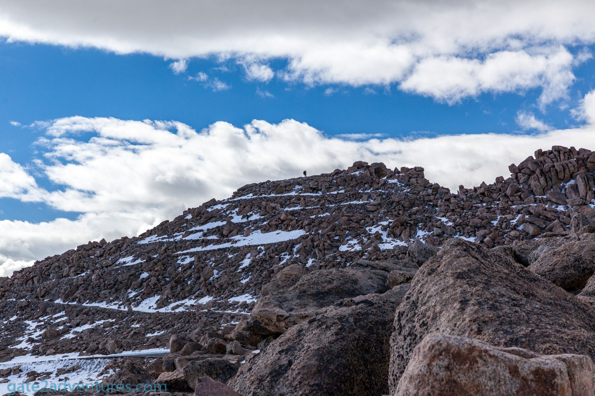
The last 5 miles of your ascent is probably the most challenging once but also offer a tremendous view along the way. The road is narrow and has multiple switchbacks. Your final stop will be at the parking lot at over 14,130 feet. Did you ever think it would be so easy to tackle your first 14er? Now you can tell your friends and family you been at the top of a mountain which is over 14,000 feet above sea-level.

Be aware of altitude sickness and know the symptoms. If you experience one or more of the symptoms start heading back down. Altitude sickness is a serious condition and not to mess with. Drive a few miles down and see if you get better. If so you can try another ascent but try it at a slower pace and frequent stops.

Take a short but easy hike to the top of the mountain and the highest point of Mount Evans. The trailhead is located towards the north-west of the parking lot and the views are breathtaking. and you can see other 14er mountains around you. Be careful as there remaining snow and ice can be very slippery. At the top
A few points of interest which you can see from here:
- North: Longs Peak in Rocky Mountain National Park
- South: Pikes Peak, South Park, and the Sangre de Cristo Mountains
- West: The Continental Divide with Grays and Torreys Peaks
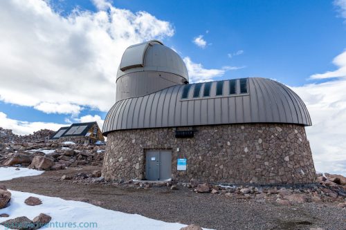
Three distinctive buildings can be found at the summit.
- The Crest House: Opened to the public in 1942 and served as a restaurant and gift shop
- The High Altitude Lab: The University of Denver constructed this wooden double-wide A-frame building in 1935 to support cosmic ray research.
- The Meyer-Womble Observatory: Originally constructed as a telescope in 1979 and upgraded to an observatory in 1997. The high altitude allows better views of the sky as there is less haze and the sky is not compromised by artificial lights from cities.
I almost forgot the most important building to all the travelers coming up here. Of course, there is a restroom up here. Stay hydrated to counteract altitude sickness.

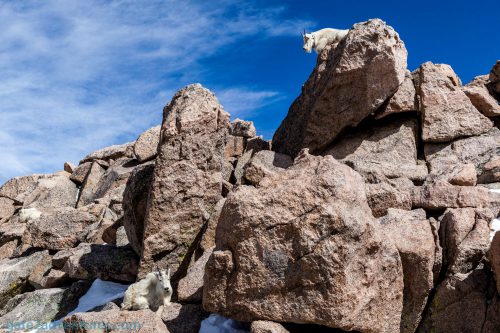
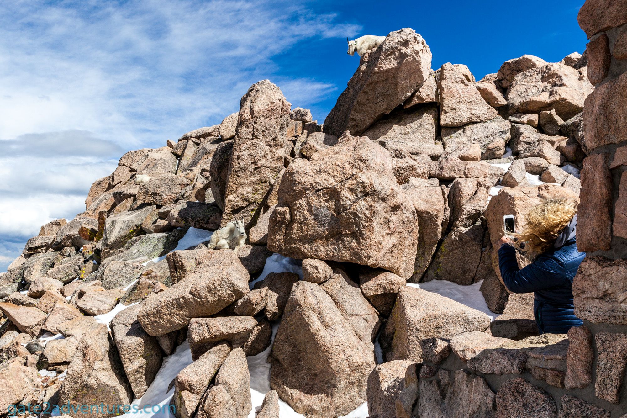
Some of the most frequent visitors of the Mount Evans summit are bighorn sheep and mountain goats. I was able to spot a bunch of them on the rocks behind the Crest House. They were just hanging out on the slopes. Respect the wildlife by viewing from a safe distance. Don’t harass, chase or feed wildlife. This is illegal.


Did you like the drive and are ready for another scenic by-way? Why not taking the nearby Loveland Pass across the Continental Divide instead of the Eisenhower-Johnson Memorial Tunnel?
Gallery
See more photos of Mount Evans.
Peter has a passion for Traveling, Photography, and Geocaching. These are the best ingredients for amazing adventures all over the globe. “Traveling is fun, no matter if you stay in a luxury hotel or travel like a backpacker.” Peter shares his experiences on his Blog www.gatetoadventures.com
Some of Peter’s photos are published on corporate websites, in-flight magazines, travel guides, and much more.

