
Reading Time: 10 minutes
Start your road trip in Roseburg, OR. Roseburg is easy to reach from wherever you come from. Directly located on the I-5 going north to Seattle, WA, and south towards Los Angeles, CA.
In Roseburg merge on Oregon State Highway 138 and follow it east to Diamond Lake. Just after Diamond Lake merge on Oregon State Highway 230 and miles down the road on Highway 62 to Crater Lake National Park. In the winter you have to take the long way to Crater Lake and use the south entrance to Crater Lake. This is the only road open in the wintertime and plowed throughout the whole time. The north entrance road is prepped for snowmobiles during winter. The North Entrance and West Rim Drive usually open in early June for cars. The East Rim Drive typically opens in early July.
About 20 miles east of Roseburg, along Highway 128, you will cross the North Umpqua River for the first time. Stop here for a Scenic Lookout at the Colliding Rivers Park. The Little River and North Umpqua River collide here frontal. The information signs at the Lookout Point tell you more about this place and its history. In the flood of 1964, this point was 5 feet underwater.


Your drive will bring you along the North Umpqua River with many beautiful sights along the way. There is so much to see and to do, that it would take forever to reach your destination. Further down the road, you will pass “The Narrows Douglas County Park” and even further down a modern concrete bridge over the river and a small park right next to it.


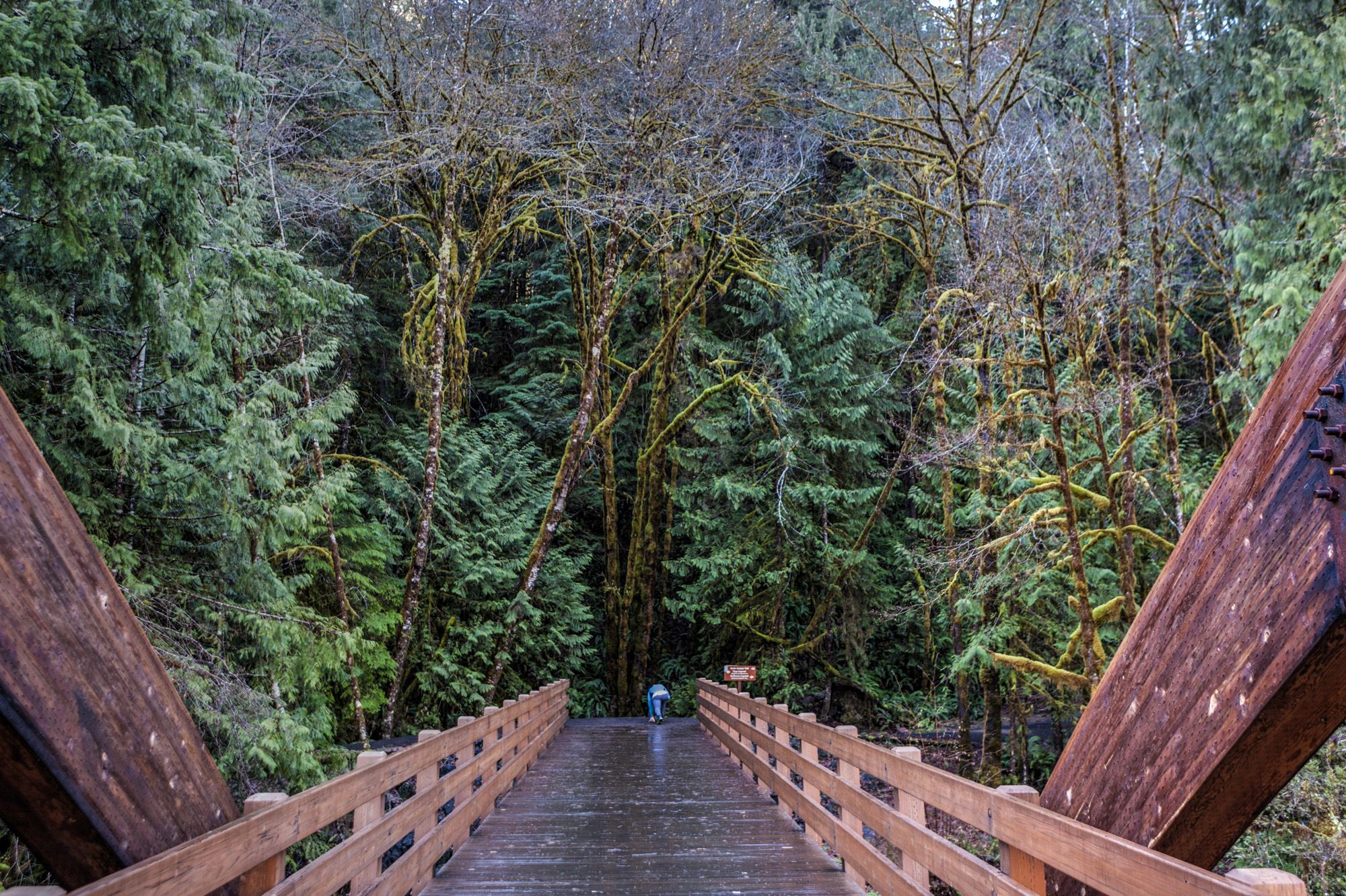
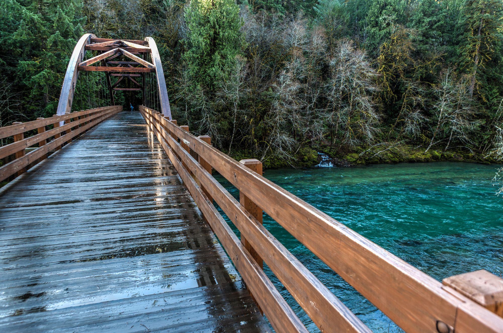
After the next couple of miles, you will see the wooden “Tioga Bridge” on your right, crossing the river to give you access to the North Umpqua Trail.


When you see the Falls Creek Falls sign coming up some miles after the bridge, make a quick stop here. Take the 1-mile round trip hike to the small waterfall and back. Cross the small wooden bridge and follow the signs to the fall.


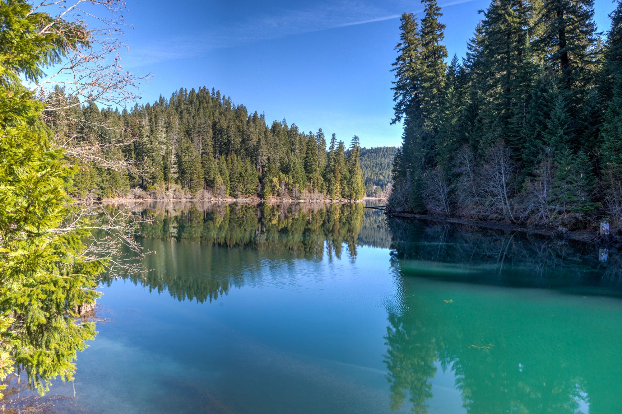
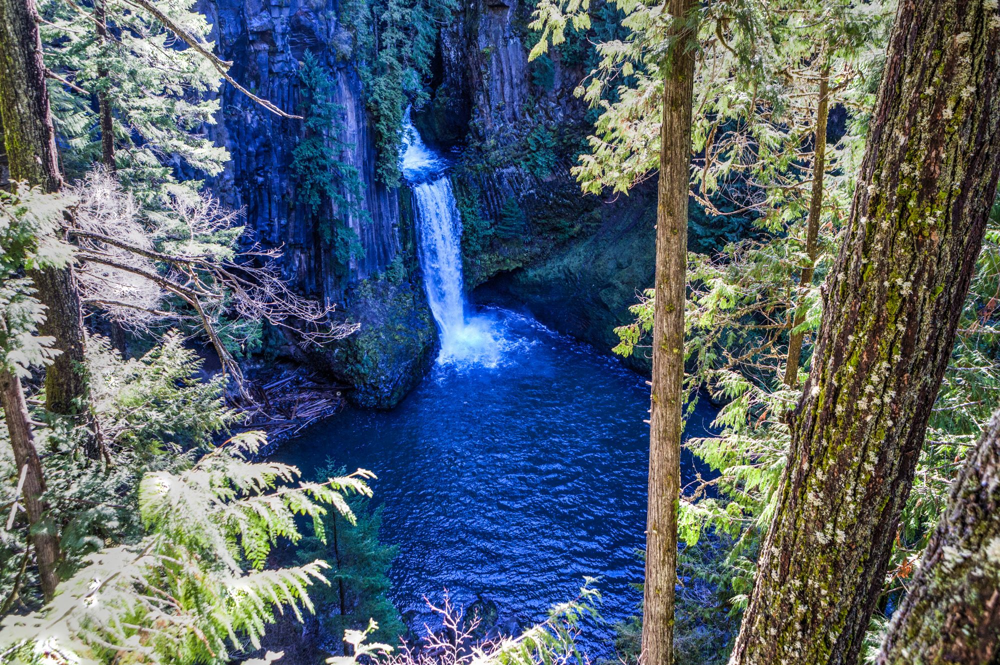
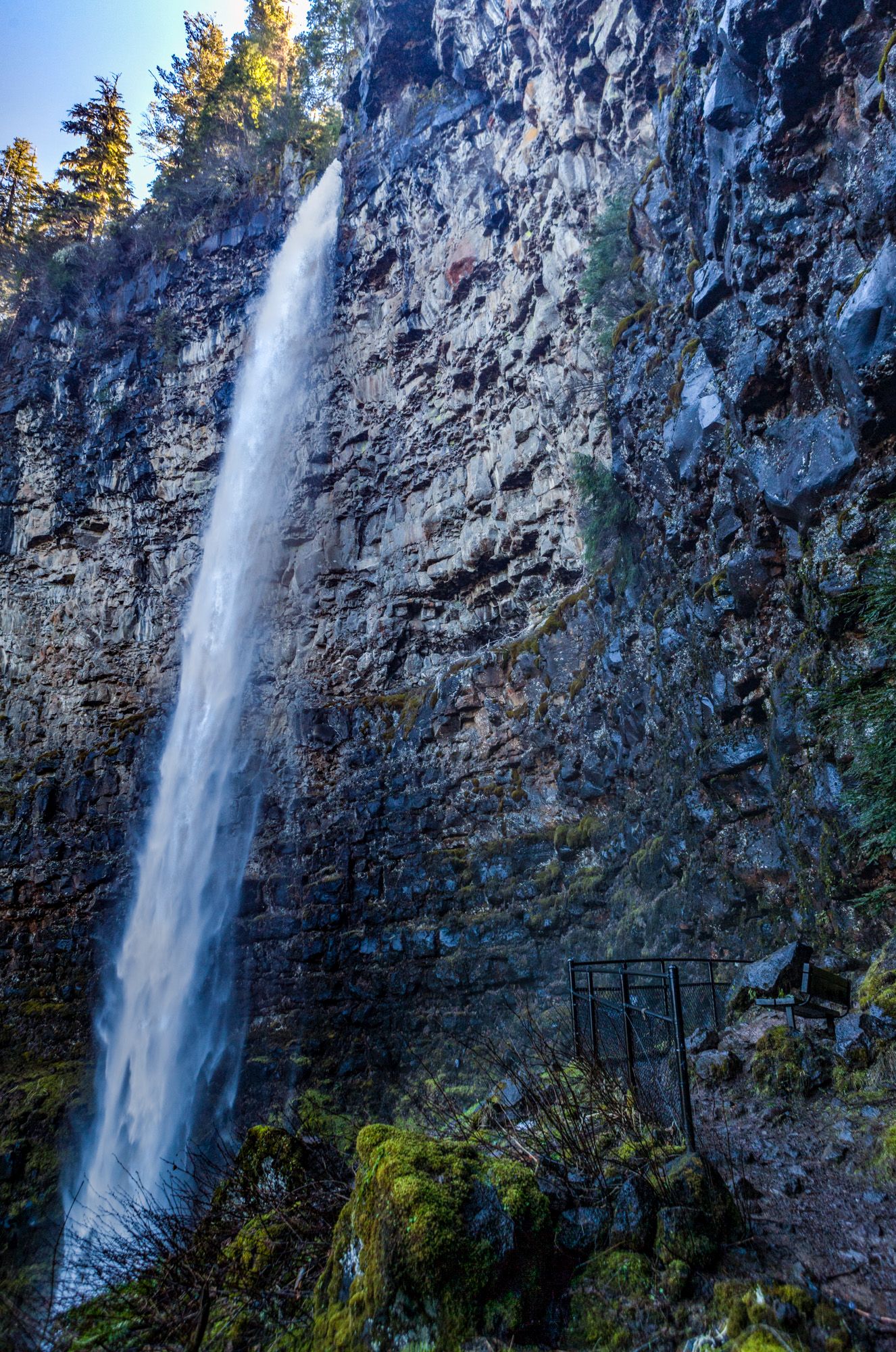
Once back on the street, you will cross the North Umpqua River a couple of miles down the road. The river will stay to your left now until you reach Toketee Lake. There are Hot Springs right next to the river and with a nice view. This is another recommended stop. Check out the Toketee Falls. The North Umpqua River plummets 80 feet through a gaping notch into a plunge pool. Before that, the river plunges 40 feet down into a secluded cavity.
The trail takes you through old-growth forests of Douglas-fir, up and down a set of stairs, to a viewing platform. The hike is less than a mile (one-way) but considered more difficult, because of the stairs and elevation change. The platform gives you a great view of Toketee Falls. The Chinook word “Toketee” means “pretty”, which perfectly describes this waterfall.


Next up is Watson Falls. With a 293-foot drop, Watson Falls is the highest waterfall in Southwest Oregon. The round-trip hike brings you to a viewpoint at the base of the fall and is just over one-mile round-trip. Four gorgeous waterfalls are adjacent to the road: Toketee, Watson, Whitehorse, and Clearwater. These four falls can be reached by a short hike. Unfortunately, the entrances to the road of Whitehorse and Clearwater Falls were not plowed and covered in about 7 feet of snow. No chance for me to get there or even park. If they are open, definitely worth checking them out as well.


Warmsprings Falls and Lemolo Falls require a longer hike than the others to reach them but are worth visiting as well.
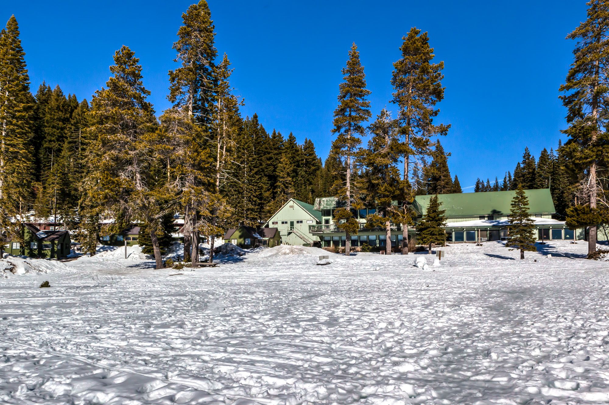
My next stop was the Diamond Lake Resort at Diamond Lake. Not a lot of roads were plowed here and most of them are prepped for snowmobile use. Heck, even the nearby gas station has one side open for cars, and the other side still covered in snow for snowmobiles to gas-up. Check your gas tank and make sure you have enough gas for the rest of the journey.

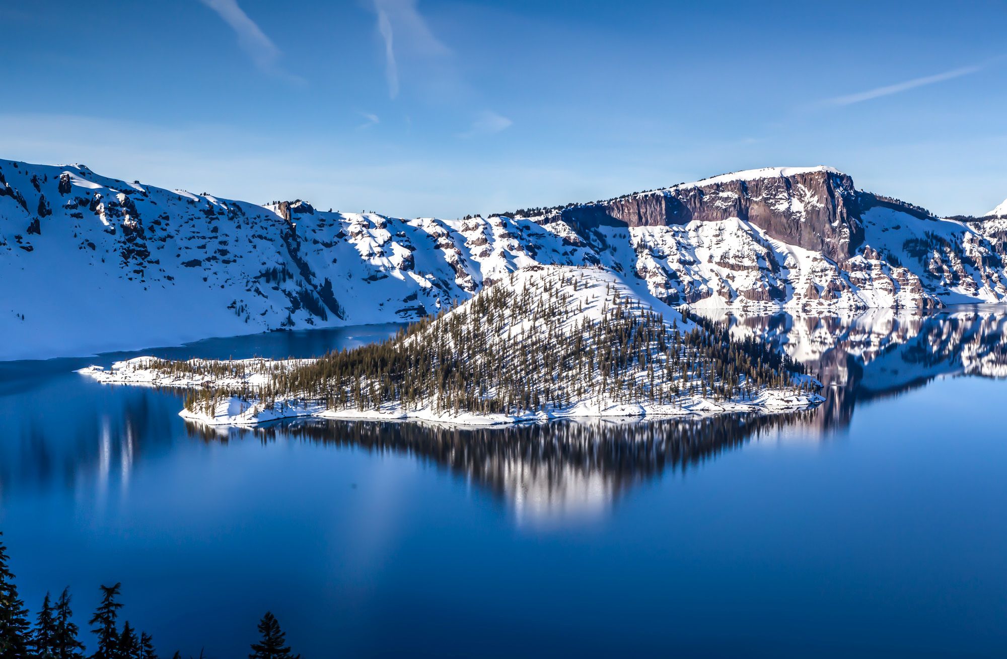
Diamond Lake was completely frozen and covered in snow on this beautiful day. I walked out on the ice a couple of hundred feet. People were out on the ice to go fishing. That was interesting to see. I bet, I can have an awesome view of the lake here during the summertime.


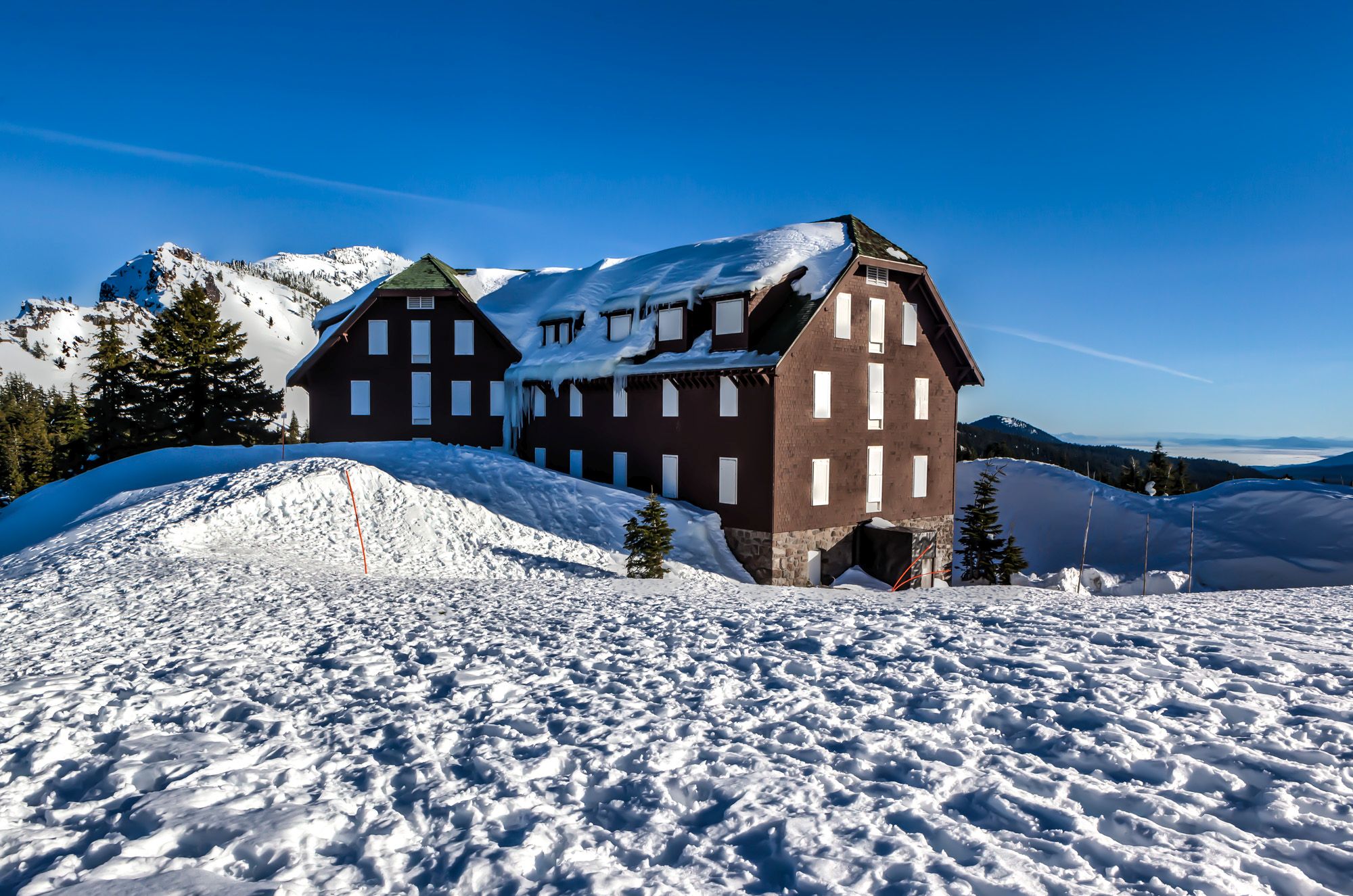
Back on Highway 138, follow it south until you see a sign for South Crater Lake Entrance. This road would be Oregon State Highway 230. Follow this highway south until you hit State Route 62 (Crater Lake Highway). This is the road that will lead you to the Crater Lake National Park South Entrance. Because it is a National Park, you would have to pay here. However, during my visit, the fee was waived. Mostly because the toll booth was so high covered in snow, that it would be hard to operate it. Follow this road for 4 miles to the Steel Visitor Center. The Visitor Center is open daily (except December 25th) from 10 a.m. until 4 p.m. during winter hours. The ranger inside can give you tips and help you plan your visit. I really got lucky by picking the right day for my visit. The ranger on duty told me that this was the warmest day since October 2015. It was true. I was only walking around in a T-Shirt when I was at Diamond Lake and it had around 60° F. The biggest and most shocking surprise was, that the lake is actually visible. Usually, during the winter month, the lake is only visible for about 50% of the time. If not visible, the lake is covered with thick clouds. Call 541-594-3100 for weather forecasts or check the webcam at www.nps.gov/crla. About 43 feet is the average amount of snow the Visitor Center gets every year from Pacific Storms.

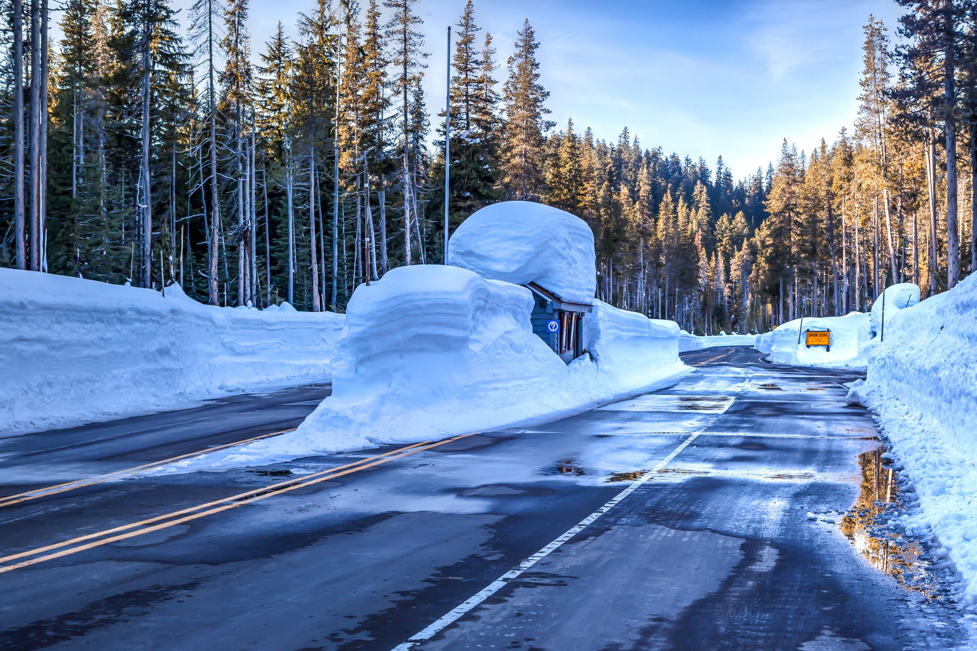


After talking to the ranger and getting some good tips on where to go at the Rim Village, I headed up the 3-mile stretch. The Rangers try to keep the road open during wintertime as good as possible and usually it’s open about 80% of the time.
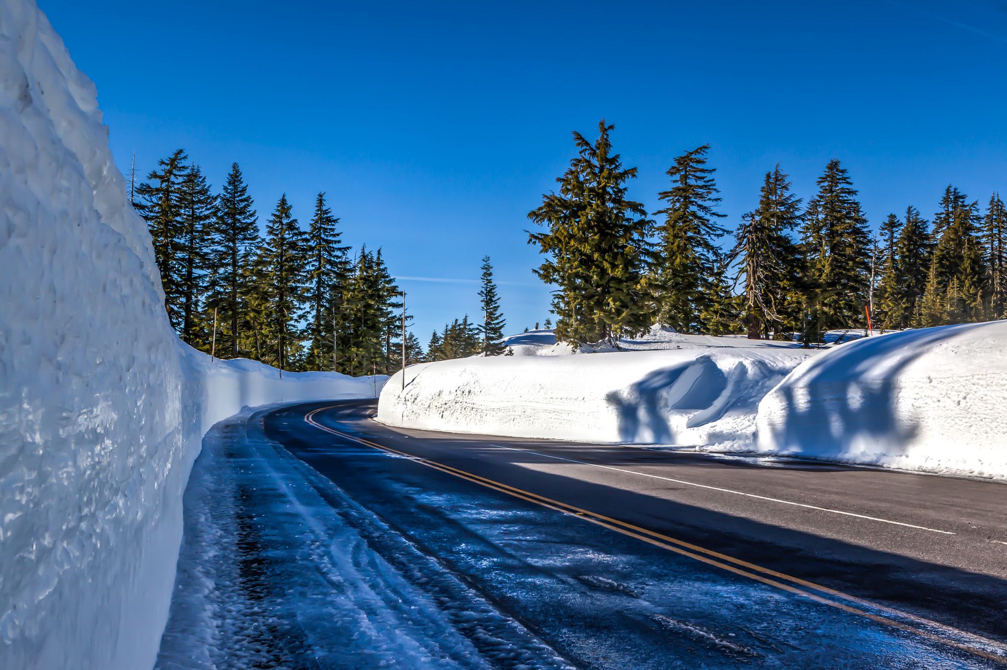
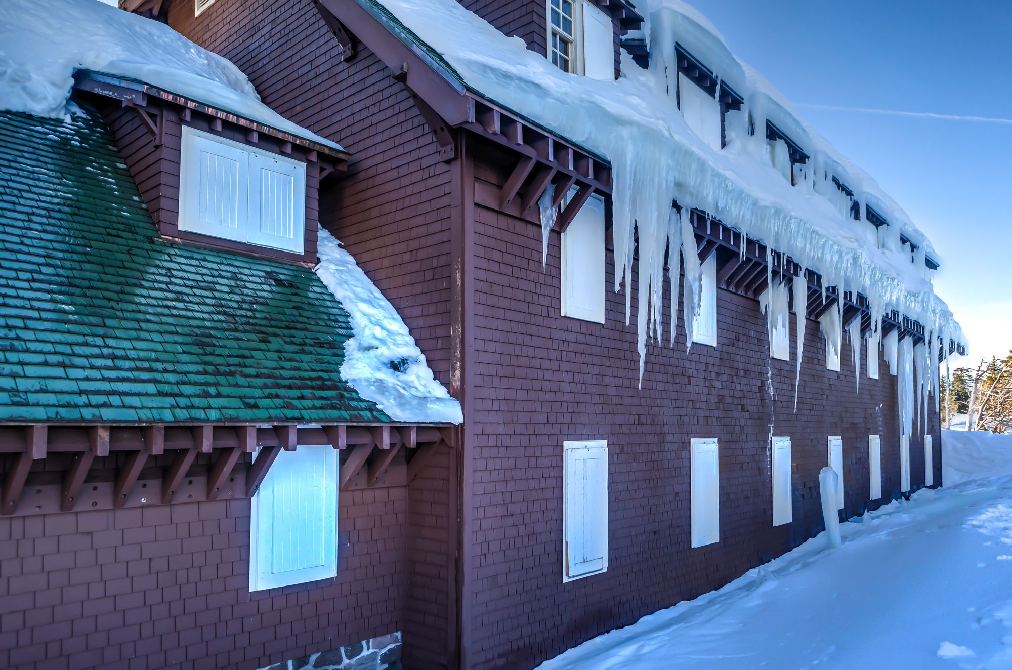
The drive was worth it when I climbed the approximately 12 feet high snowbank. There is a ramp next to the Rim Village Restroom Building. From here you can climb the snowbank easy. Be careful the ramp can be icy. Stay back from the edges. Overhanging snow over the rim of the crater can be hard to spot and are very dangerous.


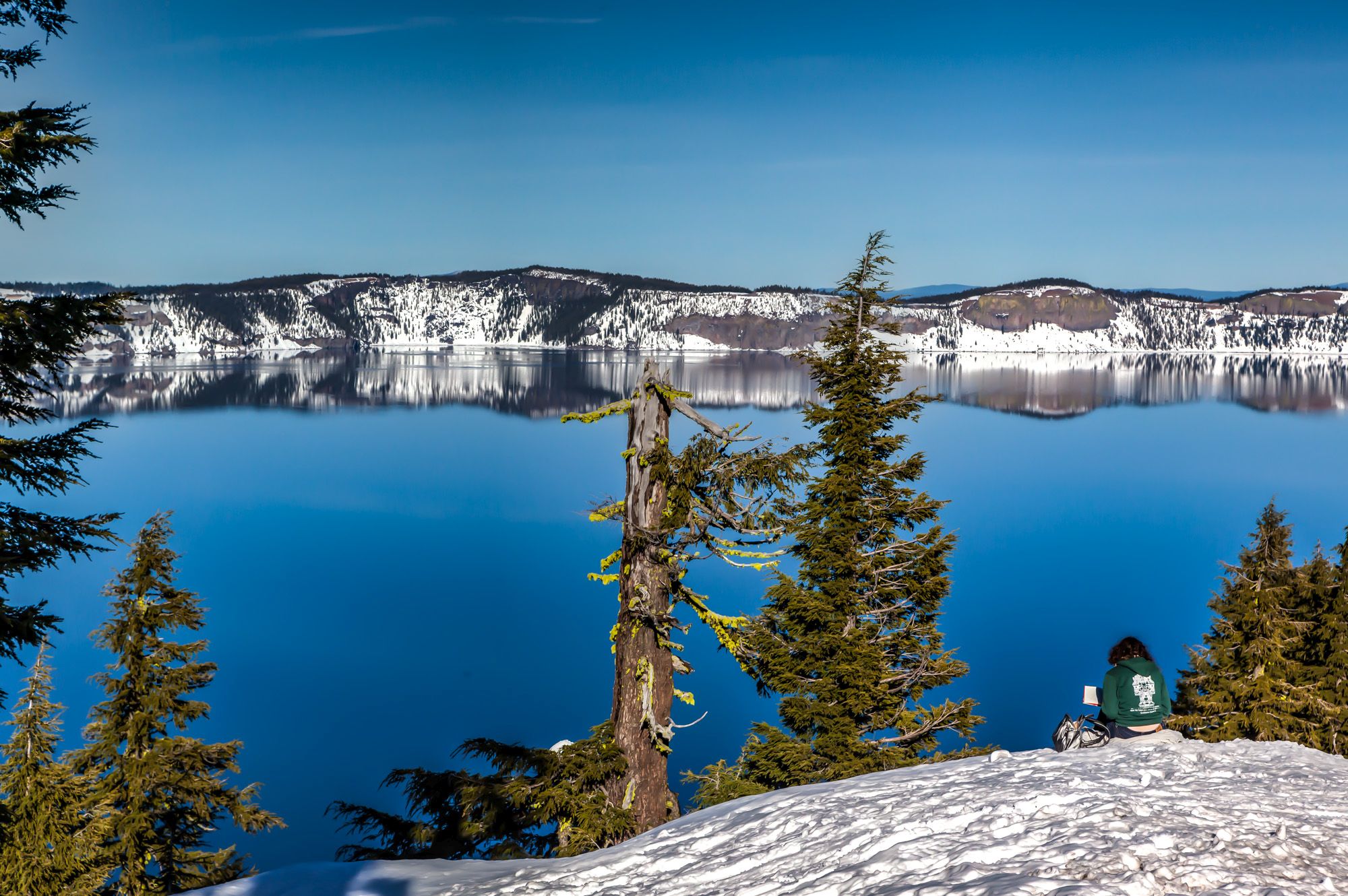
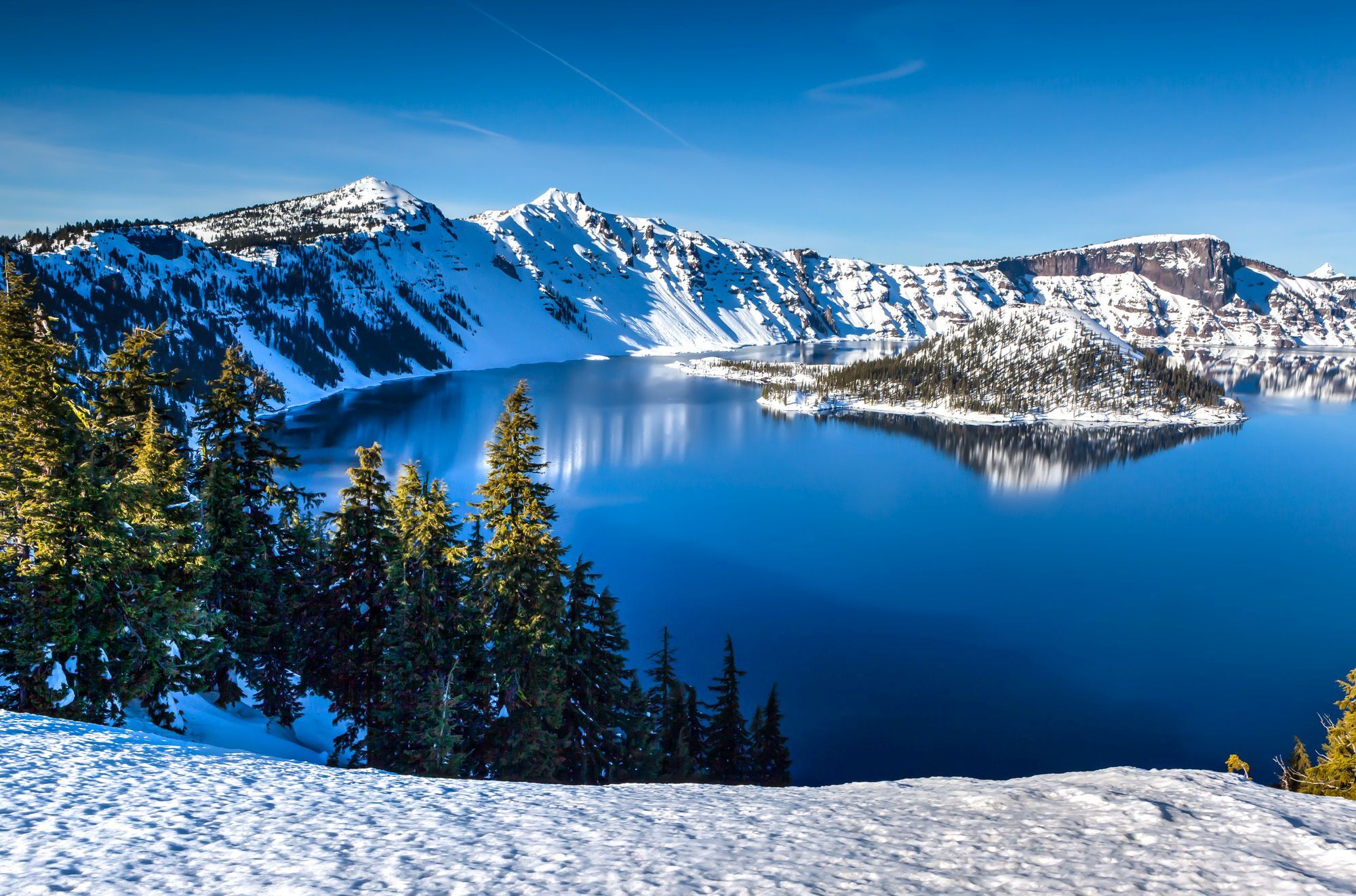
Crater Lake is the deepest lake (1,943 ft / 592 m) in the United States. The lake is also considered the cleanest and clearest large body of water in the world. Fed by rain and snow only, but no rivers or streams. The lake resides inside a caldera formed by a 12,000-foot-tall volcano, which collapsed 7,700 years ago following a major eruption.


Walk along the snowbank to get great views of the lake and Wizard Island. The east and west rim drive are groomed for cross-country skiers. When you walk atop the snowbank, be prepared to sink in a bit with most steps if you don’t wear any snowshoes. You can rent snowshoes at the Rim Village Gift Shop. Unfortunately, the gift shop was closed when I visited because of a power outage.
The complete Rim Drive is about 33 miles long and it attracts cross-country skiers in the wintertime and bikers, hikers and cars during the summer to take this beautiful and scenic drive.


Join a Park Ranger every Saturday and Sunday at 1 p.m. (from late November until the end of April) for a 2-hour snowshoe walk. Snowshoes are provided free of charge and no previous snowshoeing experience is necessary. The space on each tour is limited and advanced registration is recommended. Register at the Steel Visitor Center or call 541-594-3100.
It was such a gorgeous day to be out here and finally see this lake myself. It was on my bucket list for a long, long time, but I never had a chance to come here.
This is a great road trip and absolutely worth every minute and every penny you will spend on it. Have you been here? If so, when during summer or winter?
Peter has a passion for Traveling, Photography, and Geocaching. These are the best ingredients for amazing adventures all over the globe. “Traveling is fun, no matter if you stay in a luxury hotel or travel like a backpacker.” Peter shares his experiences on his Blog www.gatetoadventures.com
Some of Peter’s photos are published on corporate websites, in-flight magazines, travel guides, and much more.


Subscribe
4 Comments
planning to visit Crater Lake on in December with 2 children, ages 4 and 8, along with 2 other adults. The 4 year old is… Read more »
Hi @susan_galler:disqus the South Entrance is open year round and leads you all the way to Crater Lake Lodge. Still check the National Park website… Read more »
Thank you for the suggestions. The registered walk is on Sat. and Sunday at 1:00 AT Steel Visitor Center (includes snowshoes). Register at 541 594-3100.
I don’t know how challenging the snowshoe walk is. Maybe you can get a sled and drag the 4 year old along the trek. Otherwise… Read more »