
Reading Time: 4 minutes
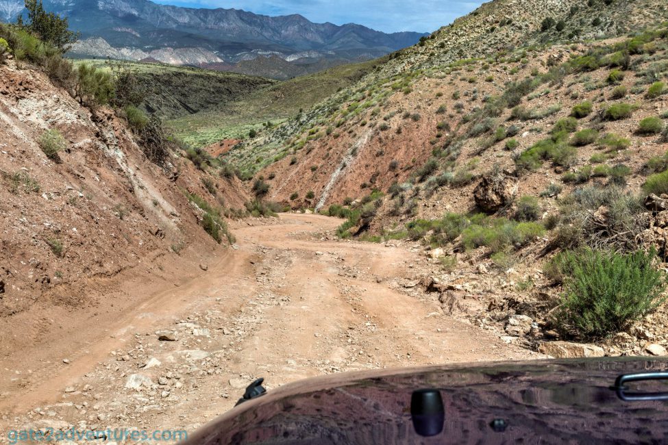
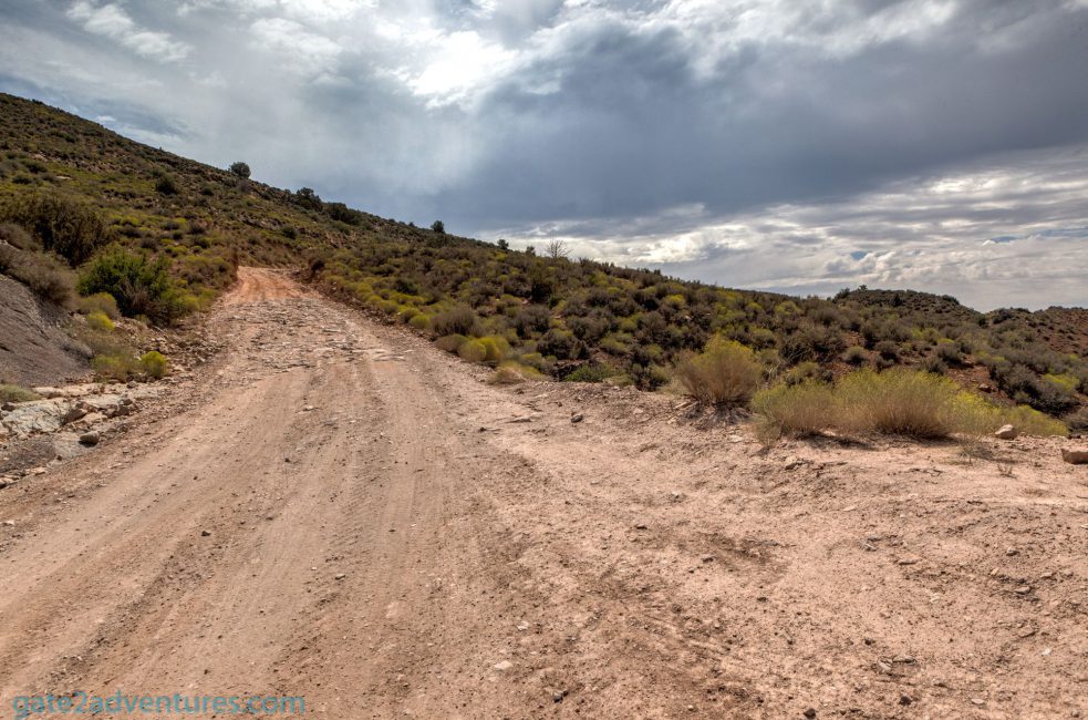
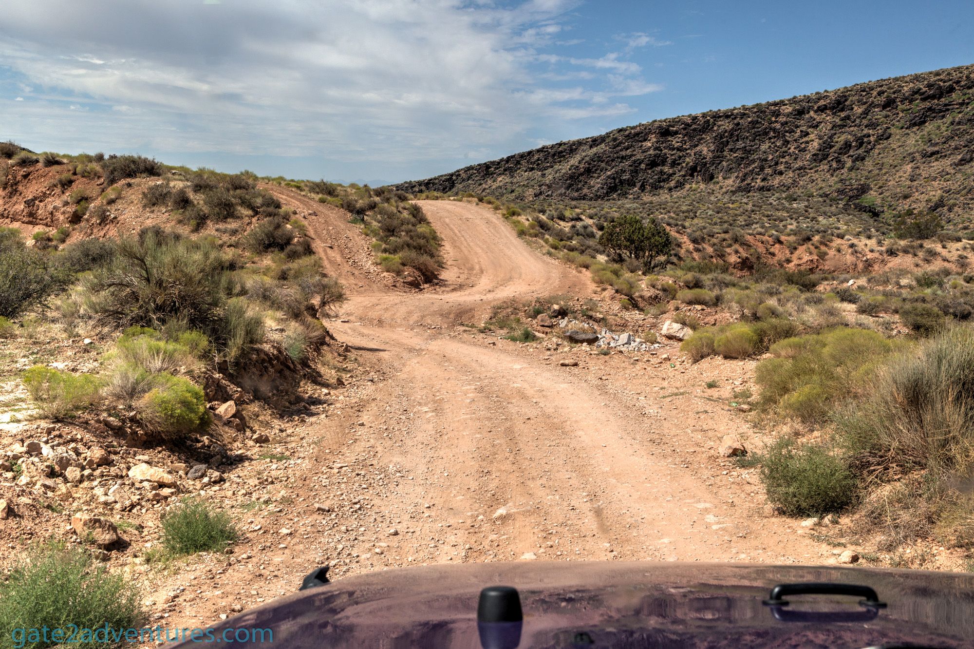
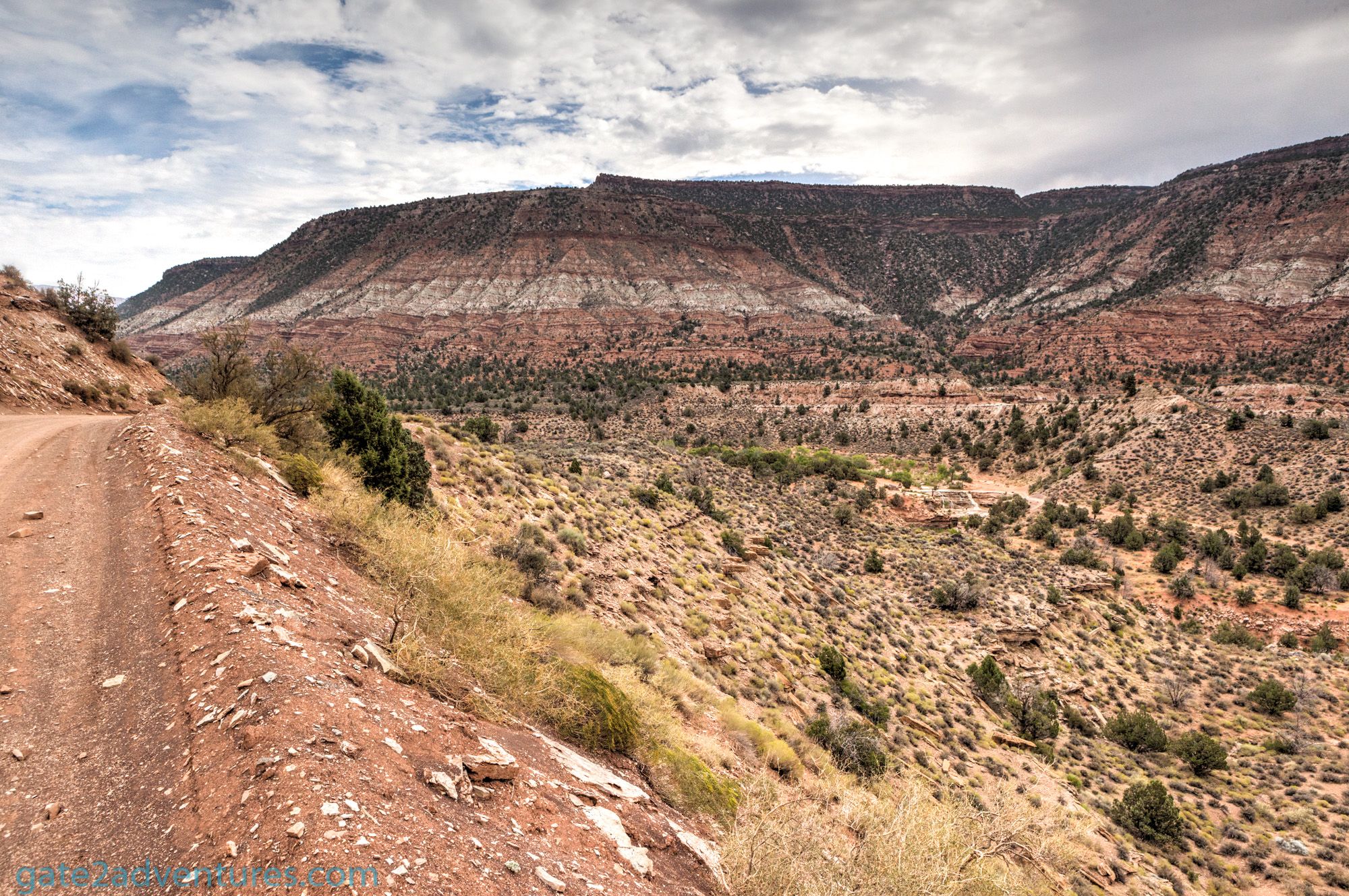
The Toquerville Falls is located off the beaten path just outside of Toquerville in Southern Utah. It is about a 30-minute drive from Saint George to Toquerville and from there another 30 minutes to get to the falls. The easy part is getting to Toquerville. Starting in Toquerville you have to take an extremely rough road to the falls. There is even a sign before you leave the paved area mentioning these conditions and that a four-wheel-drive vehicle is recommended. I would go so far as to recommend an SUV-style vehicle only. You want to have some ground clearance as you have to climb over some obstacles along the way.

The first 2 miles are the hardest. Once you successfully conquered that part, it’s pretty much an easy drive to the falls itself. The start of the trail is an extremely rough road. There will be smaller boulders and rocks on the trail, which you have to pass. That’s why I highly recommend a vehicle with some clearance. A Subaru Outback might not be the right choice. You can make it, but you should be extremely careful.
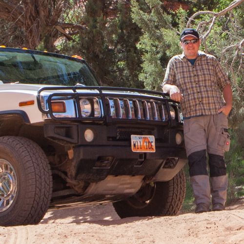
I went on this trip with a Jeep Wrangler (see my review) and had no issues driving to the falls. This Jeep is the perfect companion for a drive like this. Once I reached Torquerville Falls, I saw another car parked there. It was a Suburban but with 4-wheel drive.
Getting there
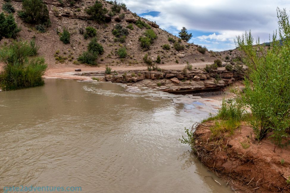
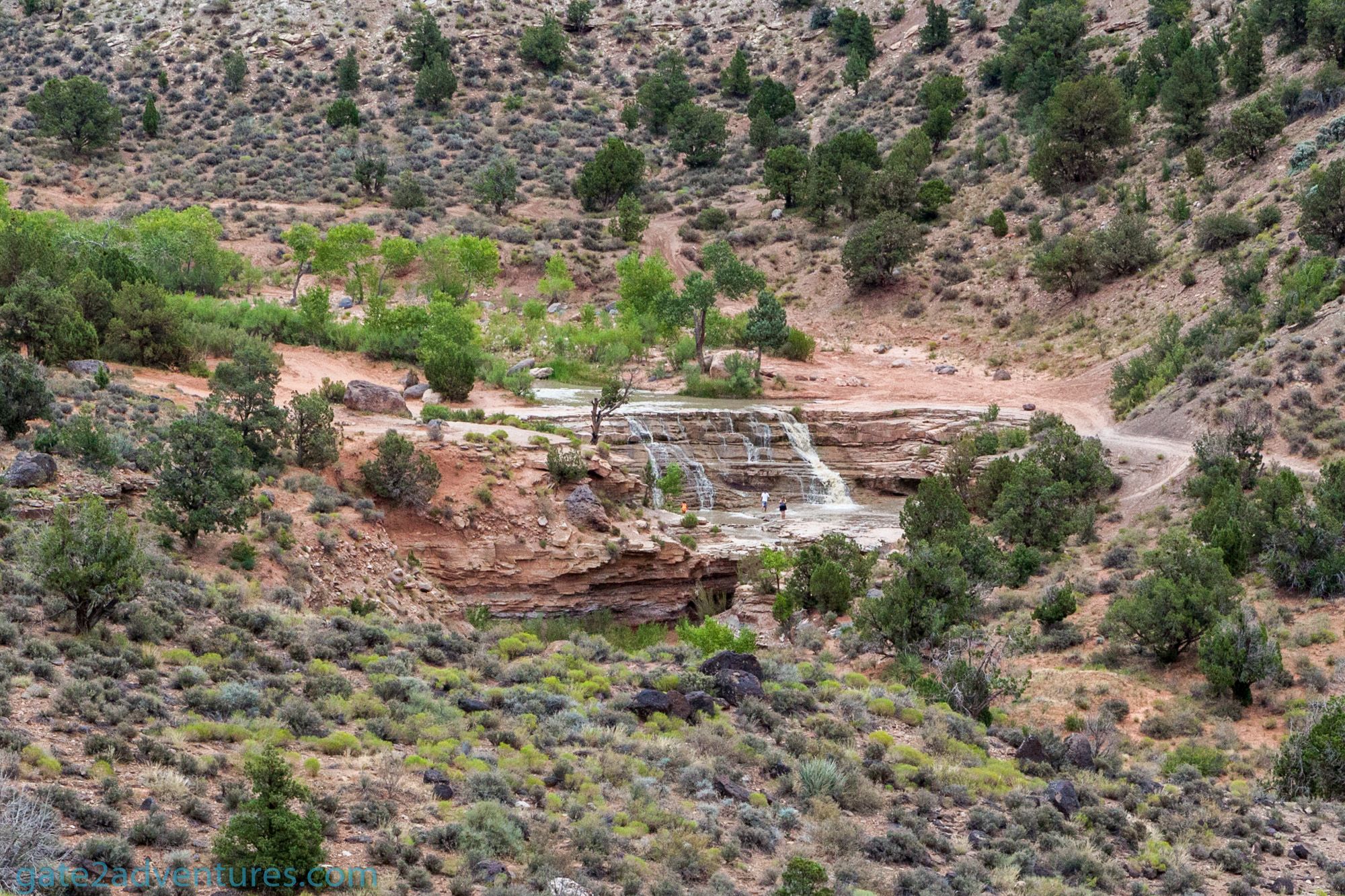
From Toquerville you have to take Spring Dr. almost all the way to the falls. Keep your eyes open, the falls will appear on your right once you head down the last hill. You can see the fall in the distance. Once you made it down the hill you have to make a right to get to the falls themselves. There is no sign but it’s the only trail that intersects with the Spring Drive trail. You can also download the GPX file below and follow my route to get to the falls. You need an app on your phone or a GPS unit that can handle GPX-files. For Android, I can highly recommend Locus Map. There is no cell phone reception once you leave Toquerville and you might not even meet other people out there. Be prepared and check your spare tire. Drive carefully and cautiously. If you are unsure how to take a section of the road, step out and check. Also, be careful around corners. You might encounter other off-roaders and be prepared to stop to avoid collisions.
Toquerville Falls, Utah
Below some pictures taken along the way to Toquerville Falls. Don’t get a false impression. The road on the pictures doesn’t look too bad but you will encounter difficult spots and hard to pass sections for a compact car or even an SUV without 4-wheel drive.


Locus Map
Locus Map is available in a free and paid version. The free version had enough functionality to use the GPX-file but is limited in comparison with the Pro-version. I would highly recommend buying the pro version. This app is amazing and very helpful for hikers and off-roaders. I use it all the time and it’s a real lifesaver.


Toquerville Falls
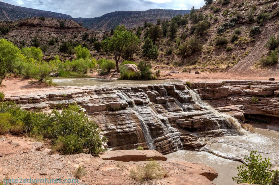
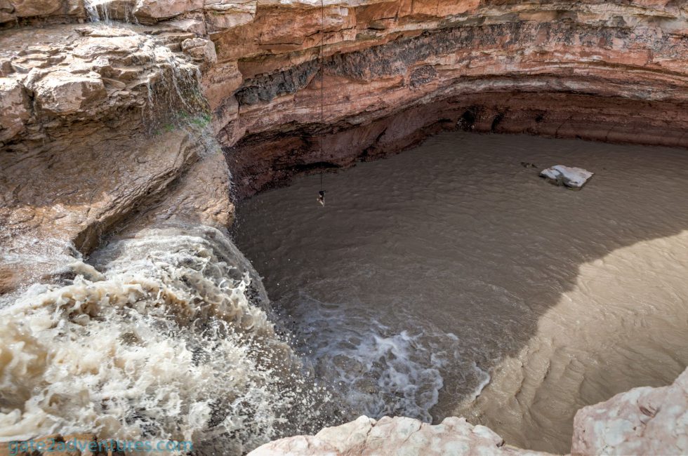
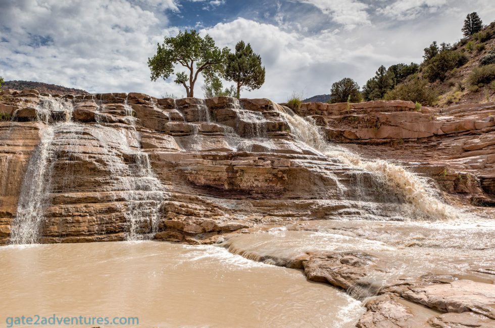
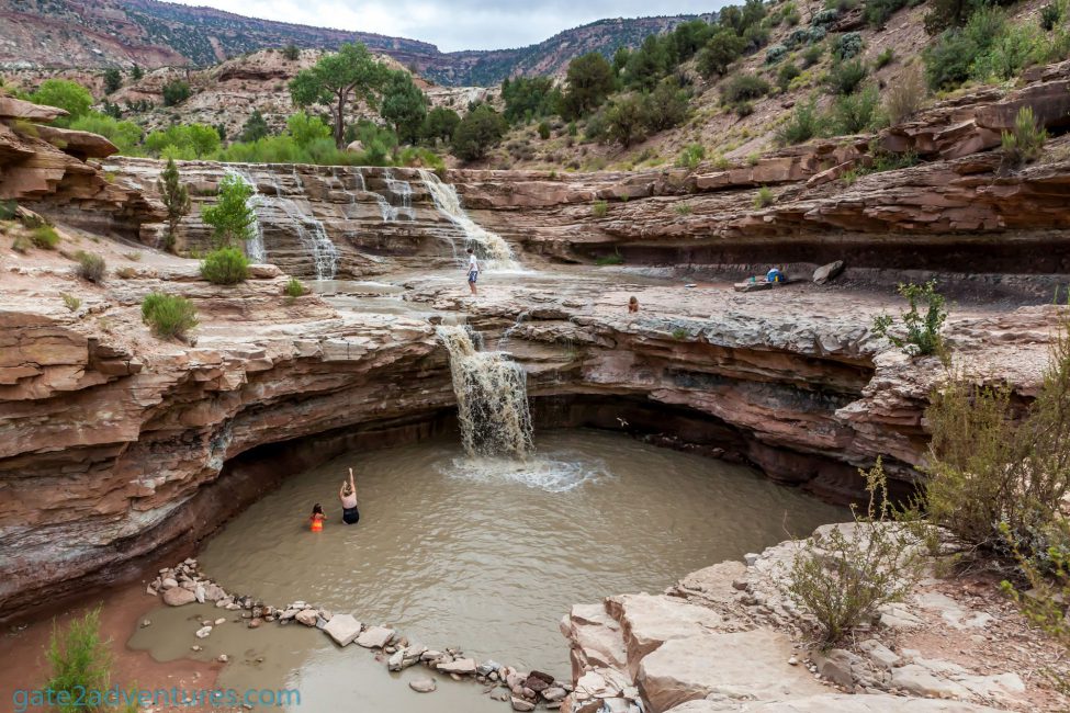
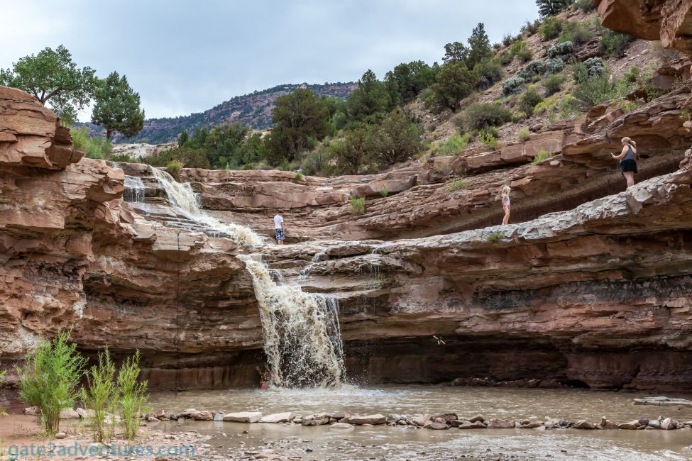
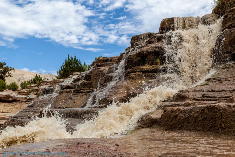
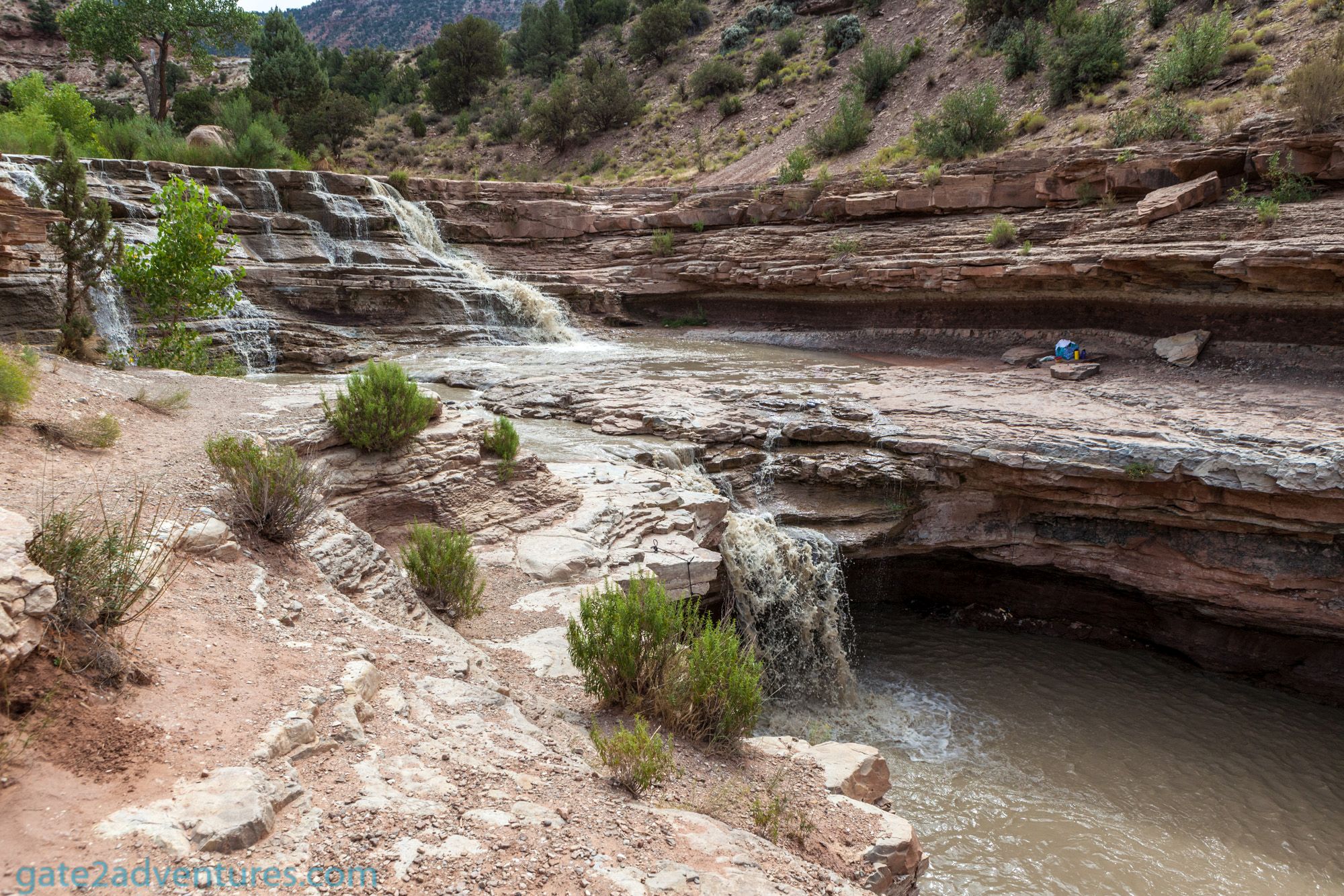
Toquerville Falls is a great and beautiful two-stage waterfall. La Verkin Creek feeds the waterfall and runs into the Virgin River just southwest of Saint George. The waterfall carved an amazing swimming hole at the bottom section of the falls. There used to be a wooden ladder from the swimming hole up the little-elevated platform but this one is gone. You can still see it on older pictures. At the same spot is now a rope with climbing loops to climb up there.
Be also careful around the waterfall edges. They can be slippery and can lead to serious injuries. There might be also flash floods, which can be very dangerous. If it rains further up north, you might not even notice it but the wall of water will run down the creek and can be extremely dangerous. The depth of the water can vary and make sure it’s deep enough before you jump otherwise you could injure yourself badly. When I got there, there was a big storm going through the area just 2 days ago and the water running down the creek was still dirty and muddy. You can see it in my pictures. This was unfortunate but I don’t know when I get the next chance to come back here. Normally the water in the creek is clear at the falls but not suitable for drinking.
The car, as I mentioned earlier, belonged to a family and they took their kids out here to cool down on a hot summer day. It was around noon when I arrived there and the family and I were the only people there. On my way back out, I encountered another group coming in on an OHV to go to the falls.
These falls in the middle of the desert are worth a trip and are mostly only known to the locals. This and the rough road to access it prevent this oasis from becoming an overcrowded tourist attraction.
Gallery


Peter has a passion for Traveling, Photography, and Geocaching. These are the best ingredients for amazing adventures all over the globe. “Traveling is fun, no matter if you stay in a luxury hotel or travel like a backpacker.” Peter shares his experiences on his Blog www.gatetoadventures.com
Some of Peter’s photos are published on corporate websites, in-flight magazines, travel guides, and much more.


Subscribe
1 Comment
[…] When I got a chance I took the Jeep out on a little harder trail to Toquerville Falls just north of Saint George. The… Read more »