
Reading Time: 2 minutes
GCmap.com is a fantastic map if you want to plot your flight on a map. GC stands for Great Circle. The great circle path is the shortest path on the surface of a sphere. To be accurate, the term geodesic path should be used since Earth is not a true sphere.
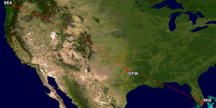
The website is great to plot your flight path and find the miles you will earn during this flight. It always turns out to be very accurate on the distance. You can search by Airport code, which makes it very easy to plot a route. You can even do a route with multiple legs. For example type in MIA-DFW-SEA: This maps the route and gives you the mileage of the different legs plus the total mileage.
You can select what kind of map should be shown for your route. It also shows useful Airport information. It also can help visualize your trip.

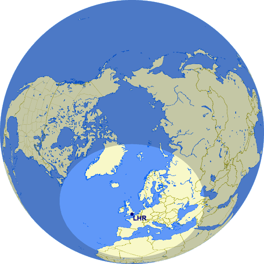
You can also show a range on a map. For example the picture/map shows a radius of 2000 Nautical Miles around LHR (London Heathrow)
Just enter 2000nm@LHR in the search field and hit enter.
Just had over to GCmap.com and try it for yourself. It’s a very useful tool especially for frequent flyers.

Peter has a passion for Traveling, Photography, and Geocaching. These are the best ingredients for amazing adventures all over the globe. “Traveling is fun, no matter if you stay in a luxury hotel or travel like a backpacker.” Peter shares his experiences on his Blog www.gatetoadventures.com
Some of Peter’s photos are published on corporate websites, in-flight magazines, travel guides, and much more.


Subscribe
1 Comment
[…] and distance between different cities. This was also the reason why I found this page. I used the Great Circle Mapper before to calculate… Read more »